Why Do Construction Engineers Survey Land?
Do Construction Engineers Survey Land?
Land Surveys highlight property lines, contours, and other relevant site features that are vital for the efficient planning and execution of construction works. Accordingly, it signifies the question: Do construction engineers carry out land survey work?
Besides planning and designing a particular construction project, construction engineers are responsible for supervising its execution. However, land surveying is performed by qualified land surveyors whose trade is measuring and mapping land. While construction engineers do not conduct surveys, they need them to be able to perform their duties accurately. They utilize survey findings to outline the scope of work on site clearing, foundation excavation, and orientation of the superstructure, in order to avoid building on fill.
The Role of Construction Engineers in Land Surveying
Construction engineers specialize in the design and management of the construction of new or existing buildings, roads, and bridges. Their competencies are limited to the analysis of the structural, material, and execution calculations of the project but not to the plan of the land. But, construction engineers are depending on land surveys to make site development decisions.
What Is Land Surveying?
Land surveying refers to the act of measuring the land and its features as well as mapping these features with great detail including the boundaries, elevations, and any other details of the terrain. Land surveyors use high quality equipment like GPS devices, total stations drones and others to take comprehensive measurements required.
Who Conducts Land Surveys?
Professional Land Surveyors
With regard to legally sanctioned resource estimation, a land surveyor is expected to be licensed, for mapping purposes. A land surveyor is an expert in the measurement and mapping of a parcel of land as it pertains to properties. So that estimates can be validated legally, such professionals must go through a number of training programs and certification steps.
Surveyors collect data related to the land using theodolites, total stations, drones, GPS tools, and other sophisticated technologies. Their work is prepared in the form of maps and reports which are assets to property owners, engineers, and contractors, as they work as official documents outlining the findings.
Construction Engineers and Surveying
A professional surveyor still needs to be engaged even in cases where construction engineers are involved, however, they may do some scans of the area in the absence of a surveyor. These engineers study survey reports and maps and try to adapt the planned engineering works to the contour of the land.
Construction companies that are big may have a civil engineer on staff and such engineers may do some basic surveying work like set the site and elevation, however, a certified land measurer is needed if legal and formal measures of the boundary markings are required.
How Construction Engineers Utilize Land Survey Information
Construction engineers rely on land surveys to make sure that the projects are carried out as they are planned at all times. Here is how this data is useful in construction projects:
1. Site Planning and Design
With the survey data, engineers comprehend the shape, elevation, and even the soil features of the land. This information allows them to create an optimal arrangement for the positioning of buildings, roads and other pieces of infrastructure. Engineers have to modify their designs in case there are steep slopes or unstable soil at a location.
2. Foundation and Structural Integrity
Constructing a structure without a proper foundation is as useful as molding clay without a pot. Proper land surveys facilitate engineers in understanding what type of foundation would be ideal with what soil, groundwater and other elevation features. This avoids failing structures while maintaining a sound and stable base for the long term in the region.
3. Legal Compliance and Boundary Verification
Land surveyors divide the land into different properties and easements which construction engineers use to make sure that the buildings do not trespass into neighboring lands or breach zoning laws. This eliminates legal problems and guarantees the compliance of the construction with the municipal laws.
4. Planning of Roads and Their Adjacent Drains
For the construction of new roadways, pathways, and drainage systems, survey data is crucial. Flood and erosion prevention is vital and engineers analyze maps to establish where the water will best be drained.
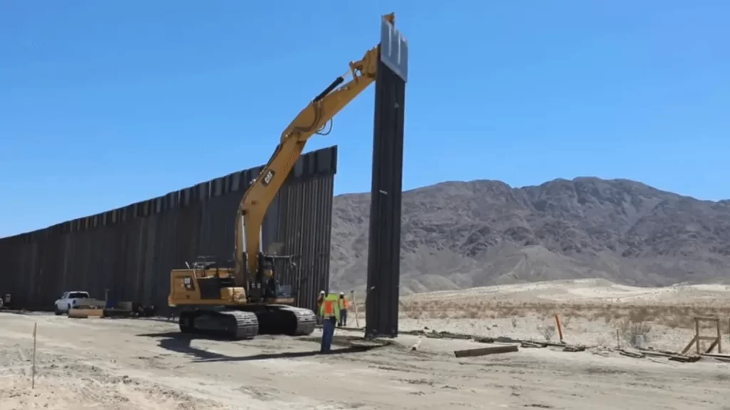
5. Site Layout and Construction Management
As a project progresses into the construction phase, engineers utilize land surveys to ensure that construction is compliant to the design plans. Surveyors play a critical role as they must coordinate the changing of certain heights, positioning of certain components, and the restricting of the area from which the work is done.
Do Construction Engineers Ever Perform Land Surveys?
Construction engineers are not trained to perform proper land surveys, although some engineers may possess one or two skill sets of surveying, thus being able to do minor survey work in the field which may include:
- Monitoring elevation and measurement outlines of a building site as work progresses.
- Operating basic survey apparatus, such as leveling instruments.
- Relative position of boundary or limits of construction and building works.
A legal boundary survey must be completed by a licensed land surveyor. For any engineering project, surveyors will always be relied on to provide accurate and official documentation of the measurements for the site before any plans are executed.
You may find this informational: Can Land Be Used as Equity in a Construction Loan?
The Difference Between Land Surveyors and Construction Engineers
| Aspect | Land Surveyor | Construction Engineer |
| Primary Role | Measures and maps land. | Designs and oversees construction projects. |
| Responsibilities | Establishes property boundaries, topography, and elevation. | Uses survey data for planning and execution. |
| Legal Authority | Provides legally binding survey reports. | Follows survey data but does not conduct official surveys. |
| Tools Used | GPS, total stations, theodolites, drones. | CAD software, construction management tools. |
| Final Output | Survey maps, property boundary reports. | Engineering plans, structural blueprints. |
So, does construction engineering involve land surveying? The simple answer is no, not in a formal sense. While construction engineers depend heavily on surveys during the planning and execution phases of a project, the actual land surveys are the work of licensed land surveyors.
Nonetheless, construction engineers, as well as land surveyors, work together as a team. Engineers need survey data for designing structures that are safe, efficient, and compliant so that everything is in order from the ground up. Sometimes, engineers do some surveying work to check whether the conditions at the site match what was expected, but for reliable measurements and legal documents, land surveyors are necessary.
